
GIStract: Free High-Speed Spatial Data Processing
GIStract provides free browser-based GIS tools for Flash Flood Screening, spatial analysis, Coordinate Conversion, GeoJSON visualization, and free report & map downloads.
Flash Flood Screening Tool
Screen runoff, peak flow (Qp), terrain, and flood-prone areas using DEM and SCS-CN analysis.
Run ScreeningPrecision Coordinate Converter
Convert and reproject global coordinates with interactive map visualization.
Open ConverterProfessional GIS Data Converter
Convert SHP, KML, DXF, CSV, GPX, and GeoJSON formats instantly online.
Convert DataGeoJSON Viewer & Editor
View, validate, and edit GeoJSON files directly in your browser.
Open Viewer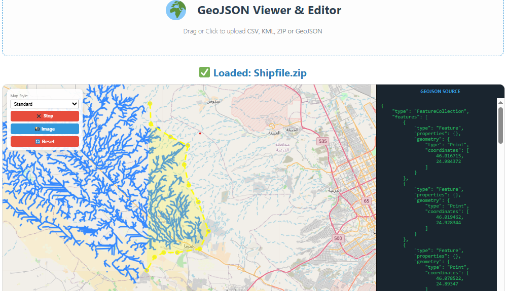
Why Choose GIStract for Spatial Data Processing?
In the world of Geographic Information Systems (GIS), speed and accuracy are essential. GIStract provides a seamless environment for Spatial Data Processing, allowing users to handle complex geographic information without the need for heavy software installations. Whether you are working with WGS84, UTM, or searching for a reliable GeoJSON visualizer, our browser-based tools ensure high-speed results.
Key Features of Our Spatial Tools:
- Global Coordinate Conversion: Instant transformation between international coordinate systems.
- No Installation Required: Access professional-grade GIS tools directly from your browser.
- Privacy Focused: We process your data locally, ensuring 100% security and no mandatory login.
- Developer Friendly: Easily visualize and verify your spatial datasets for web mapping projects.
“Your privacy is our priority. All spatial data processing happens locally in your browser. We do not store or upload your files to any server—100% secure and private.”
Advanced Spatial Data Processing for Everyone